Recent searches
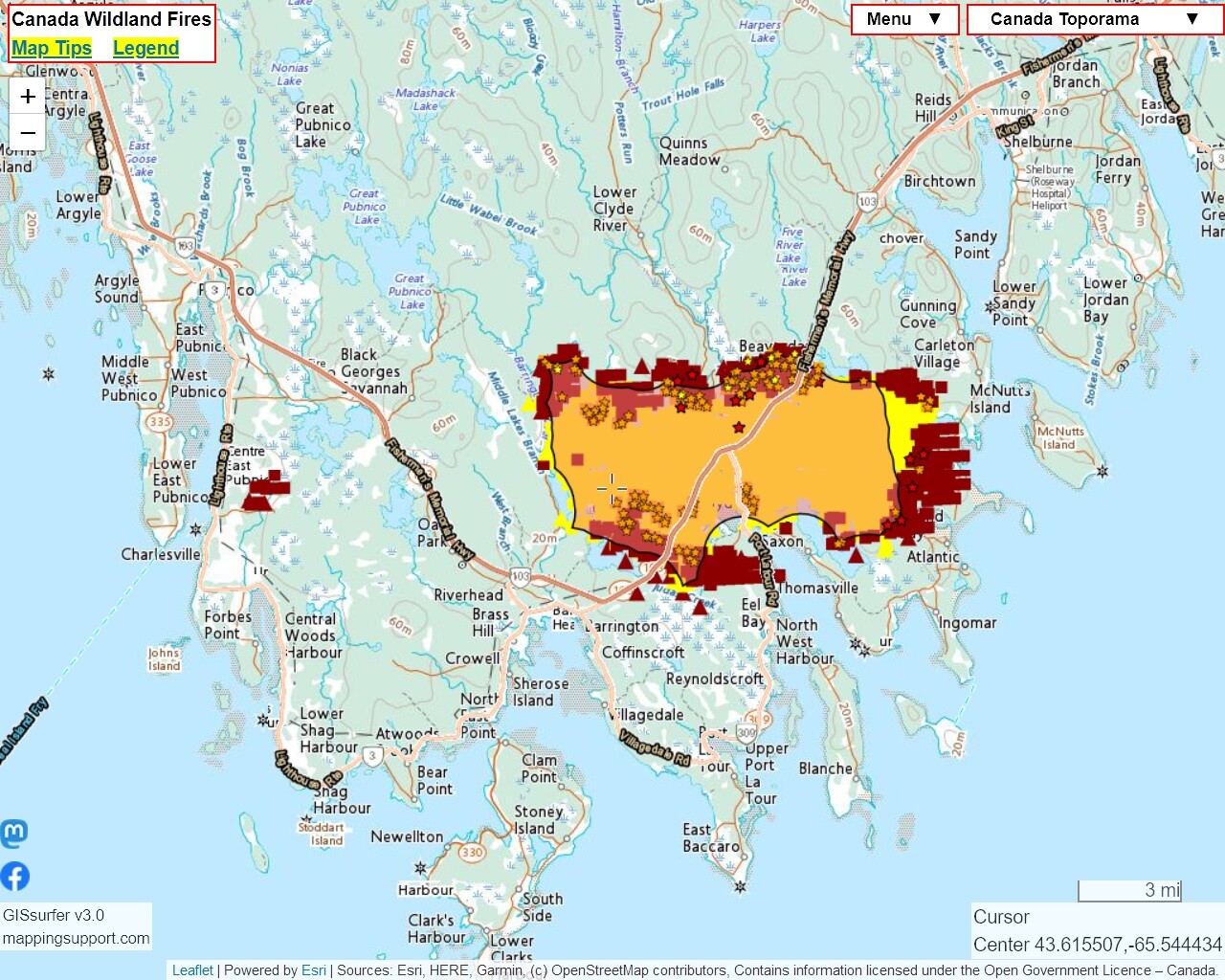
Search options


Latest satellite heat detection data (dark red) shows #BarringtonLakeFire in #NovaScotia might be burning to water’s edge to the east in a couple of places.
#BarringtonLake #Barrington
Note also the heat detections to the west for a different fire.
If you zoom in then you can see heat detection symbols over water. Good reminder that (1) each heat detection symbol refers to an *area* and (2) sometimes the data is 'false positive'.
Open #GISsurfer map:
https://mappingsupport.com/p2/gissurfer.php?center=43.607062,-65.532074&zoom=11&basemap=Canada_Toporama&overlay=CA_fire_perimeter,MODIS_7_day,VIIRS_7_day,CA_M3_hotspots_last_24_hours,World_transportation&txtfile=https://mappingsupport.com/p2/special_maps/disaster/Canada_wildland_fire.txt

@mappingsupport Don't often hear about the Great Atlantic Firebreak.